
 EN
EN
 ar
ar bg
bg hr
hr cs
cs da
da nl
nl fi
fi fr
fr de
de el
el hi
hi it
it ko
ko no
no pl
pl pt
pt ro
ro ru
ru es
es sv
sv tl
tl iw
iw id
id lv
lv lt
lt sr
sr sk
sk sl
sl uk
uk vi
vi et
et hu
hu th
th tr
tr fa
fa ms
ms hy
hy ka
ka ur
ur bn
bn mn
mn ta
ta kk
kk uz
uz ku
ku
Inclinometer
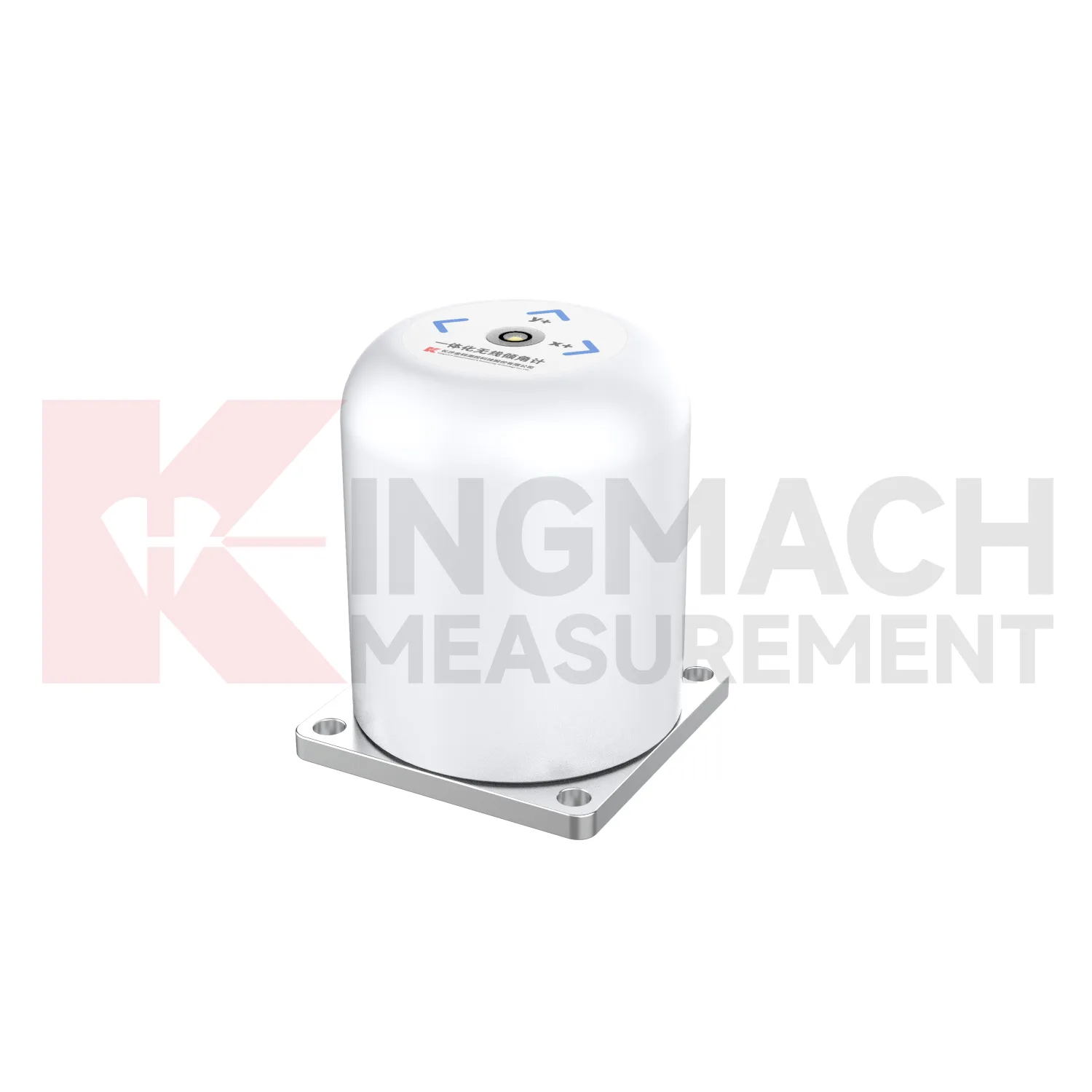
The JMQJ-7315RTU integrated tiltmeter expands Kingmach Inclinometer into wireless remote monitoring. It combines a fixed MEMS tilt sensor with 4G communication and intelligent chip technology, allowing long-term automatic testing of bridges, buildings, railways, and hidden structural parts. The product page lists +/-30 degrees dual-axis and +/-15 degrees dual-axis measurement ranges, 0.001 resolution, +/-0.05%FS accuracy, 3.6V 38AH battery power, wireless 4G digital output, -10 degrees Celsius to +55 degrees Celsius operating temperature, +/-0.1%FS per degree Celsius temperature drift, +/-0.1%FS per year long-term stability, and IP65 protection. This model is suitable where wiring is difficult, cabinet distance is long, or the owner wants unattended acquisition. The specification should still define mounting position, axis direction, transmission interval, battery inspection, and data platform naming.
Application of Inclinometer
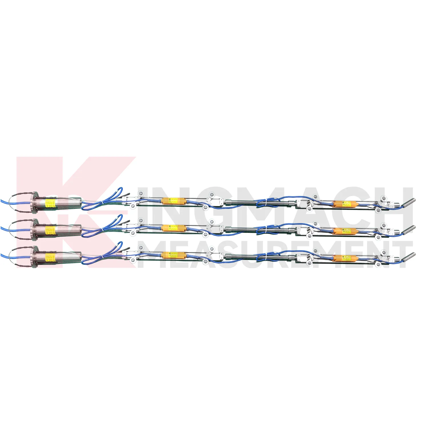
Slope and geological hazard monitoring use Inclinometer to detect internal movement before the surface condition becomes clear. JMQJ-7915ATS is especially relevant because its multi-point in-place inclinometer string can observe deformation at different depths inside a borehole. JMZX-7100L can also be used for sliding inclinometer profiling in geotechnical slopes, dams, embankment slopes, and port engineering. Slope tilt or inclinometer data should be read with rainfall, groundwater, crack width, surface displacement, retaining structure movement, and construction disturbance. The key question is often depth: is the movement shallow, deep, or concentrated along one weak layer? A borehole profile with consistent point naming and stable orientation gives engineers better evidence for warning, inspection, and stabilization planning.
The future of Inclinometer
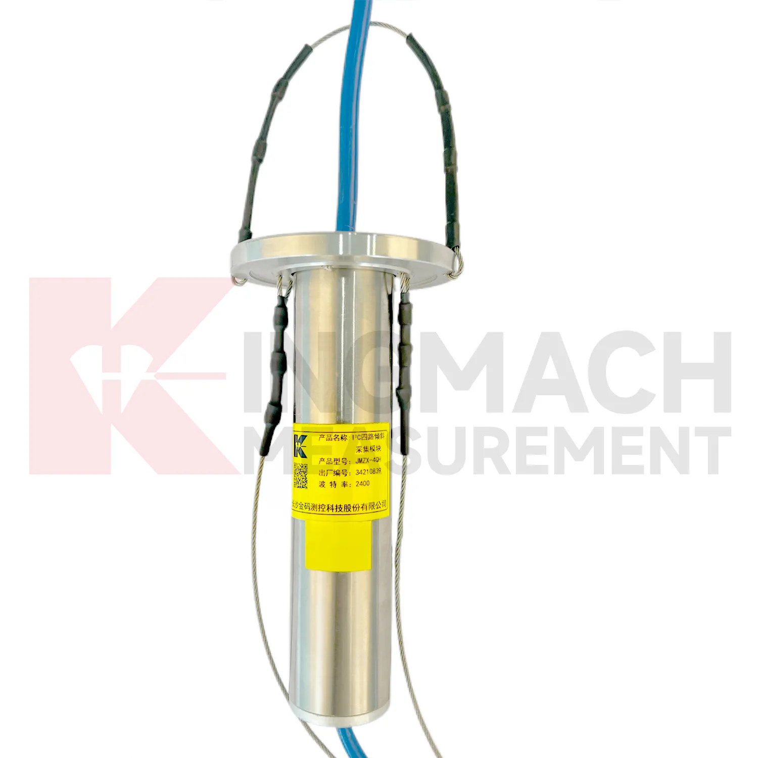
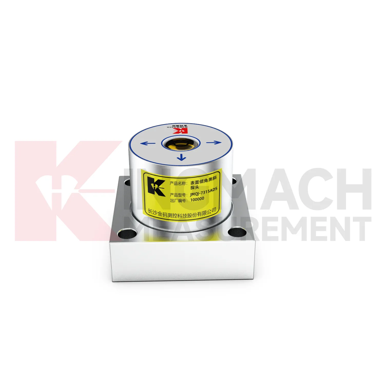
Future Inclinometer will make field commissioning more traceable. Many tilt problems begin with unclear axis direction, unstable mounting, wrong channel naming, poor cable protection, or missing baseline notes. Products with electronic identifiers and digital communication can reduce some of these errors, but field records still matter. Future commissioning tools may guide technicians through axis confirmation, zero reading, communication check, temperature note, photograph capture, and platform channel verification. JMQJ-7315ADS, JMQJ-7315RTU, JMQJ-7915ATS, JMZX-7100L, and JMZX-4QH each need different acceptance steps. A guided process can make the first reading more trustworthy and reduce later debate about whether a curve changed because of the site or the setup.
Care & Maintenance of Inclinometer
Data review is part of maintaining Inclinometer. A curve should be checked for rate, direction, sudden jumps, missing values, repeated flatlines, and disagreement with nearby instruments. Compare tilt with settlement, displacement, strain, load, pore pressure, rainfall, vibration, and water level when available. For automated systems, verify channel names, units, time stamps, and alarm thresholds after platform changes. For manual readings, keep raw field notes and processed graphs together. If an alarm appears, inspect the mounting point, communication path, recent site work, and related instrument behavior. A good maintenance process treats data quality and field condition as one record, not two separate tasks.
Kingmach Inclinometer
Kingmach Inclinometer are also part of a larger structural health monitoring ecosystem. Tilt data becomes stronger when it is reviewed with displacement transducers, settlement sensors, strain gauges, load cells, accelerometers, water level sensors, environmental instruments, readouts, cables, and visualization software. For example, a slope warning may combine deep inclinometer movement, rainfall, pore pressure, and surface crack readings. A bridge review may combine tilt, deflection, strain, temperature, and traffic loading. A building review may combine column tilt, foundation settlement, cracks, and nearby excavation records. Kingmach product categories cover many of these instrument layers, so the tilt point can be specified as part of a complete monitoring plan. That reduces gaps between measurement, acquisition, reporting, and site response.
FAQ
Q: How accurate is the JMQJ-7315ADS tiltmeter?
A: The product page lists 0.001 degree resolution and 0.01 degree accuracy for the +/-15 degree dual-axis model.Q: What protection grade does JMQJ-7315ADS have?
A: It is listed with IP68 waterproof protection and an operating environment from -30 degrees Celsius to +80 degrees Celsius.Q: What range does JMQJ-7315RTU provide?
A: The integrated wireless model lists +/-30 degree and +/-15 degree dual-axis range options, with 0.001 resolution.Q: How many sensors can JMZX-4QH support?
A: The module lists four channels and support for up to 100 sensors in a multi-point inclinometer system.Q: What is the guide wheel spacing for JMZX-7100L?
A: The sliding inclinometer page lists a 500 mm guide wheel spacing reference and a +/-90 degree sensor range.
Reviews
Andrew Lee
The visualization software is intuitive and powerful. It helps us analyze monitoring data efficiently.
James Thompson
The tiltmeters and accelerometers are very sensitive and provide precise data. Perfect for our structural health monitoring system.
Latest Inquiries
To protect the privacy of our buyers, only public service email domains like Gmail, Yahoo, and MSN will be displayed. Additionally, only a limited portion of the inquiry content will be shown.
Sophia***@gmail.comUnited Kingdom
Good day, we need environmental monitoring sensors including temperature, humidity, and wind sensors...
Ava***@gmail.comAustralia
Hi, I am looking for reliable tiltmeters and accelerometers for structural health monitoring. Please...